
Alaska: The Place That Can Show the World What AI Can Do
Alaska concentrates an extraordinary number of the conditions that make geospatial intelligence difficult.
The Ultimate Innovation Testbed
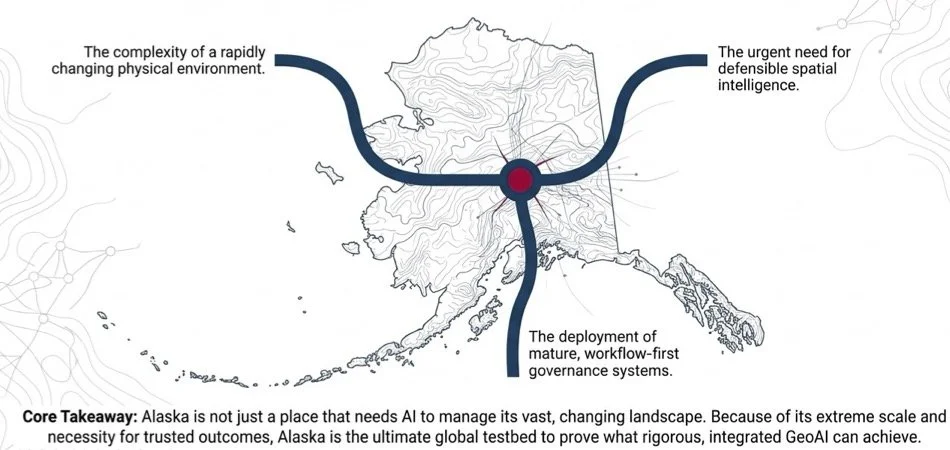
At the Alaska GeoSummit, Dr. Nadine Alameh delivered a keynote highlighting Alaska's pivotal role in global AI transformation. Her thesis was that Alaska is not just a place to apply AI to advance geospatial capabilities. Alaska is a place that can truly show the world what AI can do!
What Makes Alaska Special
Alaska doesn't give us ONE Geo/AI problem. It gives us the whole stack!
- Enormous geography (663,268 Sq. Miles): Spanning one-fifth of the contiguous U.S., Alaska's vast, remote terrain is the perfect use case for remote sensing, edge computing, and connectivity innovation (e.g. Amazon Leo or Starlink sensing devices).
- Continuous Streams of Environmental Change: Rapidly shifting permafrost thaw, wildfire vegetation changes, sea-ice erosion, and glacier dynamics require going beyond mapping, monitoring and prediction all the way to up-to-date decision intelligence.
- Sparse Ground Data & Edge Constraints: Vast areas lack ground-truth labeling and reliable connectivity, forcing AI to solve the hardest problem: inference without complete training data and autonomous edge computing.
- Multimodal Sensor Information: Demands cross-spectral data fusion of SAR, optical, LiDAR, weather, and historical imagery into a unified decision lens.
- Arctic Strategic Frontier and National Security Implications: Advances the work on trusted and sovereign AI, whic his at the forefront of the global AI dialog today.
Shaping Alaska's Geospatial and AI-Enabled Future
As an integral part of the Alaska GeoSummit, we've convened a group of leaders across government, industry, and academia to discuss how to shape Alaska's Geo/AI strategy. The forum tackled 5 questions:
- Where can Geo/AI create the biggest impact for Alaska over the next decade? aka what are the top priority application areas?
- What data, infrastructure and standards are needed to make Geo/AI successful? aka what are the infrastructure investments for Alaska?
- What would make decision makers and the public trust GeoAI enough to use in operational decisions? aka what are the guiding principles and guardrails for trusted Geo/AI?
- What ecosystem is needed to grow Alaska's Geo/AI economy? aka what are the top ecosystem investments?
- What should Alaska do to become a national leader? aka what are the rodmap priorities?
