
From Standards to GeoAI Governance - ISPRS 2026
GeoAI is transforming geospatial from mapping and visualization to planetary intelligence. Data and API standards are not enough. We must answer the trust questions. Check out the summary of Nadine Alameh’s talk at ISPRS on GeoAI governance framework for a new level of interoperability and trust for reliable decision making.
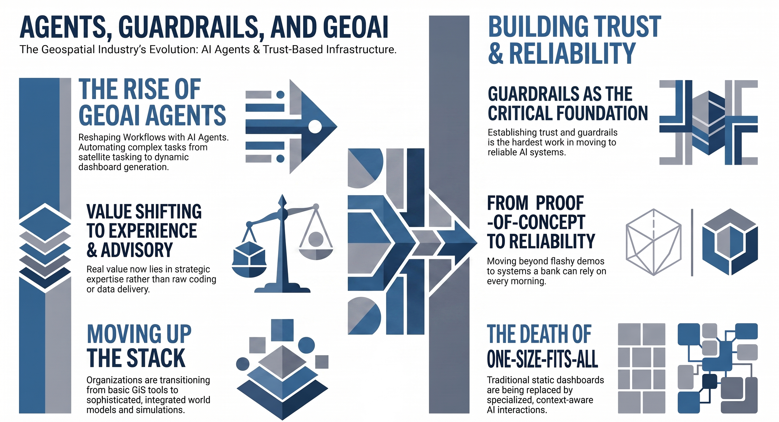
Agents, Guardrails, and GeoAI - Mapscaping Podcast
Discover how AI agents and guardrails are replacing traditional GIS dashboards. Former OGC CEO and LunateAI founder Nadine Alameh shares how to move past flashy proof-of-concepts to build trustworthy, scalable GeoAI workflows that enterprises can actually rely on.
Moving Beyond Shiny Object Experimentation with GeoAI - GIM Interview
In this interview with GIM International, Dr. Nadine Alameh shares why organizations must move beyond “shiny object” experimentation and focus on building trusted, scalable GeoAI capabilities that solve real-world challenges. Read the blog to explore mhery vision for the future of geospatial intelligence, where AI, Earth observation, and trusted data come together to power better decisions.
Changing the Future of GeoAI: A Conversation with Nadine Alameh
Explore an in-depth conversation with Dr. Nadine Alameh from GeoIgnite 2025 on the transformation of geospatial intelligence. Discover how cloud-native platforms, generative AI, and Earth Observation foundation models are breaking down industry silos to drive cross-disciplinary innovation and real-world solutions for a queryable Earth.
The Increasing Value of Geospatial Computing
Read this Geospatial World Prime opinion piece on driving value through advanced geospatial computing. Learn how modern spatial processing platforms, cloud architecture, and integrated location data maximize operational efficiency and unlock deep analytical insights to transform complex workflows across global industries and decision-making systems.
Making Earth Observation FAIR - Terrawatch
Discover the power of making geospatial and earth observation information Findable, Accessible, Interoperable, and Reusable (FAIR) with renowned geospatial visionary Dr. Nadine Alameh.
Geospatial, climate and more - GovConWire
Discover how open geospatial standards break down modern data bubbles. Dr. Nadine Alameh joins GovCon Wire to discuss driving defense and civil mission advantage through digital twins, IoT integration, and climate change analytics.
The Open Geospatial Consortium (OGC) podcast kickoff - The Open Geospatial Consortium (OGC)
Dr. Nadine Alameh discusses the power of open geospatial standards, interoperability, and collaboration. Learn how shared frameworks enable innovation, data integration, and smarter decision-making across the global geospatial ecosystem.
Standards Lie at the Heart of Data Integration
Explore this insightful Geospatial World Prime opinion piece on why open standards are foundational to seamless data integration. Discover how overcoming interoperability gaps through unified standards unlocks the full potential of geospatial data, driving digital transformation, multi-source data harmony, and smarter location-based decision systems.
Solving the Interoperability and Standardization Gaps: Collective problem solving with geospatial
Access the ITU webinar presentation by Dr. Nadine Alameh, CEO of the Open Geospatial Consortium (OGC), on solving global standardization and interoperability gaps. Learn about collective problem-solving with geodata, cloud-native architectures, geospatial data cubes, and collaborative frameworks designed to build smart cities, digital twins, and resilient disaster response systems.
What Do Geospatial Standards Look Like in 2021?
Explore how geospatial standards evolved in 2021 to drive global data interoperability, open frameworks, and technological innovation. This insight analyzes the framework of open international standards—including OGC, ISO, and UN-GGIM guidelines—and details how unified spatial data standards empower policy-makers to resolve modern social, economic, and environmental challenges.
Powering the world with Geospatial by integrating standards and innovation
In this piece for techUK’s #GeospatialFuture campaign, Dr. Nadine Alameh explains how integrating agile OGC standards with rapid innovation unlocks the power of cross-domain data. Explore how modern spatial data integration scales global capabilities in Urban Digital Twins, Earth Observation disaster response, and FAIR-aligned decision-making.